NOTE: I have changed the location finder on the menu underneath the main picture. Click here and you will find out where I am and where I’ve been.
I spent 2 nights in Willemstad, because I was awaiting delivery of the new electronic maps for my plotter. This allows me to both know where I am, and where I’m going. Really helpful when trying to avoid the large commercial vessels, other small boat people like me, and still get where I think I want to be going.
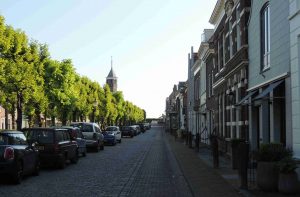
Willemstad is an historic, preserved, little town, inside a star-shaped fortification. This has been altered many times over the years, most recently during WW2, but the center remains undamaged and quaint.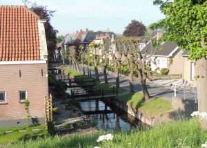
I was also entertained by the carillon that played briefly each hour. I am such a sucker for bells!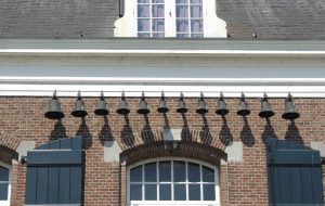
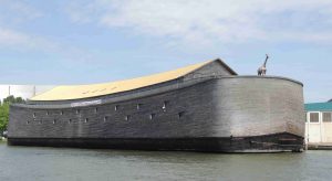
I then departed early this morning to help avoid the chop that builds with the afternoon breeze: I had to cruise up the Hollands Diep, which is a wide channel leading to a separate channel of the Rhine. I hadn’t realized this, but the current I faced certainly informed me of the amount of water flowing! On to Dordrecht, then another cross-connection of the Rhine (Maas, here), towards the Nieuw Maas the flows through Rotterdam. And what did I see? The certainly have lots of big ships here in Holland, but I am just not sure what this one might be. Any thoughts? (hint: just moored alongside the river (a VERY wide river) and look closely at the prow!)
 I’m in the marina in Rotterdam, and will head north towards Delft, next.
2 Responses to May 13